Directions
Travel To Lajitas
Whether your party is large or small, near or far, our professional team will offer a variety of transportation options to fit your needs. Our preferred vendors offer special rates on coach and aircraft charters. No matter how your group arrives, we guarantee a warm welcome.
GPS Coordinates: 29.25N 103.67W
Land Travel
Lajitas is situated on FM 170 between the Big Bend National Park and Big Bend Ranch State Park, along the Rio Grande.
Taking to the open road guarantees a close-up view of all that this breathtaking area has to offer – from the colorful cactus flowers that dot the landscape to the majestic Chisos Mountains that rise above the desert. With every passing mile, the spirit of the Old West grows stronger. Open highway speeds of 75–80 mph make the trip even shorter.
By Car
Sometimes a road trip is the best way to ease into a weekend getaway or gear up for a company retreat. Taking to the open road guarantees a close-up view of all that this breathtaking area has to offer – from the colorful cactus flowers that dot the landscape to the majestic Chisos Mountains that rise above the desert. With every passing mile, the destination draws nearer, and with each passing moment, the spirit of the Old West grows stronger.
Driving Directions can be found below.
By Train
Ride the rails in style from anywhere in the United State. Amtrak has daily service into Alpine, Texas which is conveniently located about an hour away from Lajitas. To find out more about Amtrak’s service into Alpine you can visit the Amtrak Texas Eagle page or the Texas Eagle website.
Air Travel
Private Air Travel
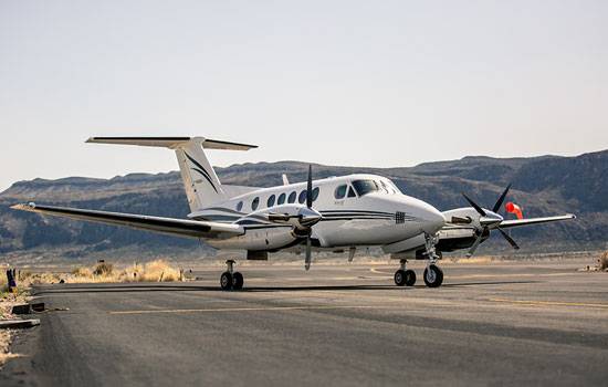
For those arriving via private aircraft, Lajitas International Airport is complete with a 7,500 foot runway. Shuttle service can be arranged to the resort by contacting the front desk at 432-424-5000. Learn more about flying into Lajitas.
Sit back and enjoy the swift flight to Lajitas
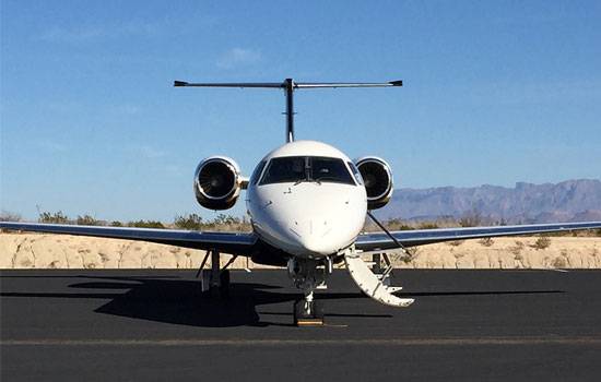
Lajitas Golf Resort now offers charter jet service flight services out of Dallas Love Airport, Houston Hobby Airport and Midland Odessa Airport.
For more information on flights click here
Driving Directions
If you choose to travel by car or chartered bus, the adventure can be as extravagant or simple as you’d like. There are a variety of unique stops along the way from most major Texas cities, from historic sites to museums and vineyards. If you choose to charter a bus, our chefs are available to cater a picnic for your group on the way from the Lajitas Golf Resort.
Alpine (approx 100 miles)
Follow TX 118S 80 miles to the Study Butte/Terlingua junction, then turn right onto FM 170 and continue 14 miles to Lajitas. Once in Lajitas, look for the state park information station (The Barton Warnock Center) to the left, and continue for approximately 1 mile until the Boardwalk and Badlands Hotel comes into view (on the left). To check in to the hotel, park behind the Boardwalk and follow signs to the Badlands Hotel for registration. To drive directly to Black Jack’s Crossing, turn left on Clay Henry Blvd just after the Badlands Hotel.
Midland–Odessa (approx 245 miles)
Head West on Interstate 20 to Monahans. Turn south on Hwy 18 to IH 10, Turn West on IH 10 for approximately 8 miles to US 67 and Alpine.
Follow US 67 South for 55 miles to Alpine, then turn left onto TX 118 South for 80 miles to the Study Butte/Terlingua Junction. Turn right onto FM 170 and continue for 14 miles to Lajitas.
El Paso (approx 300 miles)
Take Interstate 10 East for 118 miles to Van Horn. Exit US 90 East to Marfa, then turn right onto US 90 and drive 78 miles to Marfa.
Continue on US 90/67 to Alpine and turn right onto TX 118 South (Cockrell Street). Follow TX 118 South for 80 miles to the Study Butte/Terlingua Junction, then turn right onto FM 170 and continue for 14 miles to Lajitas.
Once in Lajitas, look for the state park information center (The Barton Warnock Center) to the left, and continue for approximately 1 mile until the Boardwalk comes into view. Park behind the Boardwalk and follow signs to the Badlands Hotel for registration.
Austin (approx 500 miles)
Take US 290W 75 miles to Fredericksburg and continue another 42 miles to I-10W. Once on I-10W, drive 229 miles to Fort Stockton. Continue on I-10W. Roughly 8 miles west of Fort Stockton, take Exit 248 and turn left onto US 67S to Alpine/Big Bend. Follow US 67S 55 miles to Alpine, then turn left onto TX 118S (Cockrell Street). Follow directions above from Alpine.
Dallas (approx 600 miles)
Head west on I-20, continuing 375 miles to Monahans. Take the Highway 18S exit toward Fort Stockton and turn left onto Highway 18S, then right onto FM 1776. Cross over I-10W. FM 1776 turns into US 67S. Follow US 67S 55 miles to Alpine, then turn left onto TX 118S (Cockrell Street). Follow directions above from Alpine.
Houston (approx 675 miles)
Take I-10W 200 miles to San Antonio, then continue on I-10W 300 miles to Fort Stockton. Continue on I-10W. Roughly 8 miles west of Fort Stockton, take Exit 248, then follow US 67S 55 miles to Alpine and turn left onto TX 118S (Cockrell Street). Follow directions above from Alpine.